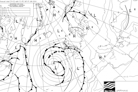
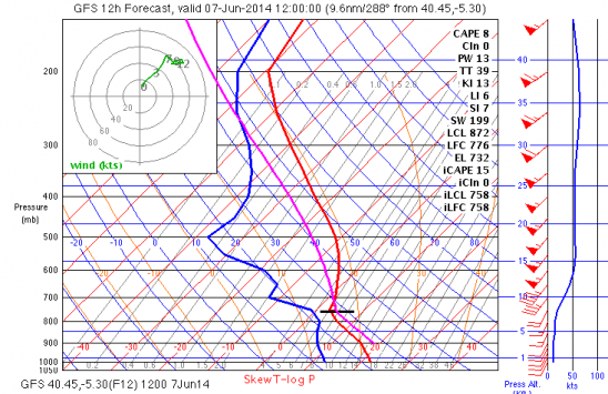
PB 127 km for Bernt. Light N wind, 3400m+ base.

Light north wind with perhaps NNW in the Avila Valley and NNE in our region will make it easier flying towards the Barco direction.  Instability still persists, but less than yesterday.  A very good XC day with high potential if the towering cumulus stays away or we can fly to a region with less problems

1500
1pm


What happened

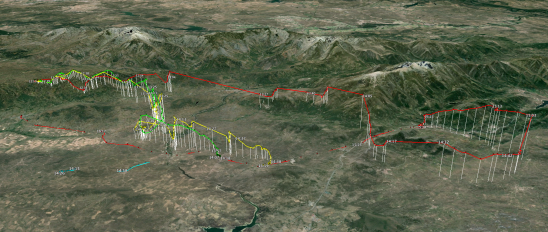
The day looked as if it was going to overdevelop early so a number of us landed before Barco.  However, it settled and got really good.  Fantastic flight by Bernt on his B class wing for his PB.  He ran the Canelario chain down to Plasencia and beyond,

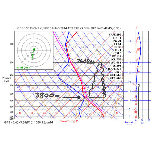
Light E, Some isolated Cbs perhaps. 3800m base

1pm

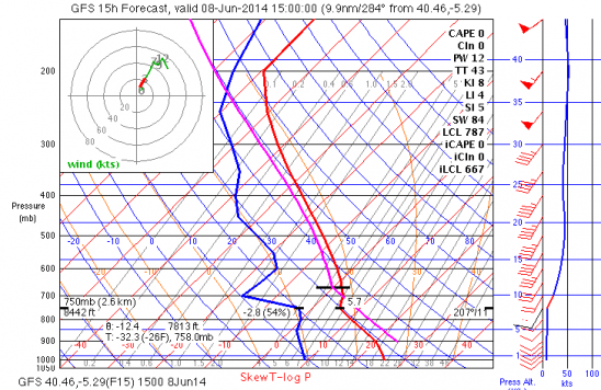
skew T 3pm


Higher temperatures today and the upper level trough has moved more to the East.  Still chance of some overdevelopment , but hopefully we can get going earlier from Peña Negra.  SE flow at take off level but will go NE.

What happened.

Great climbs from take off and we moved quickly NE to get away from the overdeveloping conditions on the main ridge.  Bernt best with a flight beyond Bejar.

tracks

Pedro

Ayer se nos fue un amigo. De repente, sin avisar. Discretamente… como hacía él las cosas.

Gracias por tu sencillez, tu amabilidad y tu permanente sonrisa.

Te vamos a echar mucho de menos.


We lost a friend yesterday. He went suddenly, without warning. With no fuss…as he normally did things.

Thank you for your easy going nature, your kindness and your permanent smile.

We will miss you lots

Some similarities to yesterday, but

A light south wind and high instability.  A higher chance of storms today with an upper level trough having passed , but still near, overnight.  Our best opportunity is to go to Chia once again early, even though I believe it will come onto PN.  In this way we can get going and away from the mountains if the day turns out to be sunnier than yesterday and we get early overdevelopment.

3pm

3pm

1pm

Lighter winds from SW. Base to 3000m. Some overdevelopment

Certainly a better forecast as far as wind is concerned with a light SW flow which would give us good convergence in the Avila Valley .  However, upper level instability is going to make things a bit too exciting perhaps as along that convergence is where we will see the quickest and biggest cumulus and development .  Probably no Cbs but Congestus big enough to perhaps keep us in the Piedrahita Valley or make us push further north.  Wind should have no problem in coming on the main site unless there is too early a build up with Cu blocking the sun when it is further lowish in the south (see https://vimeo.com/64014033 for an explanation).  Likewise with thick cirrus , which is what happened yesterday after 2.30pm

3pm

1pm

W- SW 20kmHr, inversion at 2600m

1pm

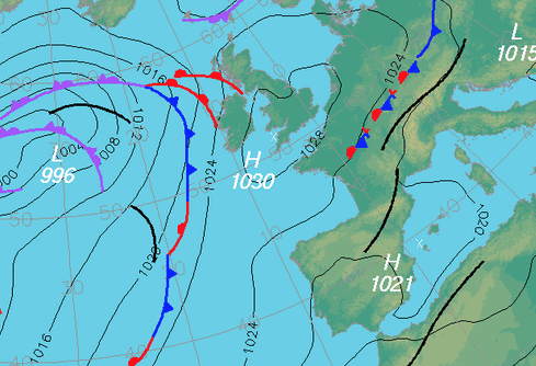
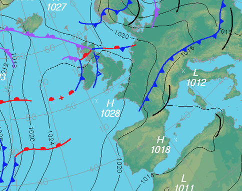
The depression in the atlantic still persists sending us SW wind, and spinning off frontal systems.

Today the wind is a little lighter, but not as much as I hoped.  It has come more to the west which is favourable for it to come onto Peña Negra launch.   At 9.30 am the wind at take off is over the back, but it is early.  As the hill warms up we can hope it will cycle on by around 11.30 .12

Flight direction towards Avila of course and the Pass can be tricky with wind and lower thermal tops.  We will talk about it at the briefing.

skew 3pm

Better

The depression in the Atlantic continues to send us wind from the SW, but not as strong.  Today around 20km at take off level but still c. 50km&hr at 3100m, which is cloud base later in the afternoon.  It may come on to Peña Negra.   We shall have to see!

1pm


Wind looks like it is coming on PN c 11.30

Too windy; as expected.

No Surprises for today with strong SW once again and the passage of a Cold Front.  I was hoping that the cold front would bring the wind more to the W for tomorrow, however, even tomorrow it still looks very top end and too south to come onto Peña Negra launch.   However, as we know from Thursday these Noa skew Ts and XC skies should not be taken as absolute truth.  The wind today is looking more W than given and if were lighter would come onto PN.

The local forecast does show a big drop off in the wind at the end of the day so there might be a slim hope for something this evening….very slim.

Puri proposes a Walk for those interested.  leaving around 12.30


NO CHANCE. Terribly windy!

The low in the  Atlandic is deepening and sending off  fronts towards the Peninsula.   Very Strong winds from SW today.  May weaken sufficiently for tomorrow evening, and Sunday shaping up and next week looking good.

Stronger winds from SW

The approaching frontal systems and relative low are going to give us a tougher time today with the winds getting strong from the SW.   There is an inversion around the 2500m level, but which will probably break to get thermal tops around 3000m by the end of the afternoon, but also there will be likely to be 40km&hr + winds at that level.

It is possible that the wind will orientate at Peña Negra, but if it does then it will be quite crossed and potentially turbulent.  At the moment the wind is quite light but  crossed from the SW.  We will probably go to the launch at Lastra (S).   If we can get away from there then we go directly ove the back to the flatlands to the NE which are reasonably friendly when flying with strong winds..