Flying forecast today tuesday 7th June.
Looking potentially very good with SW convergence. Thermal tops c 2800 rising to 3000m .Convergence along south side of Sierra de Avila.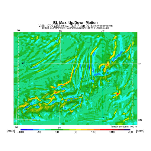
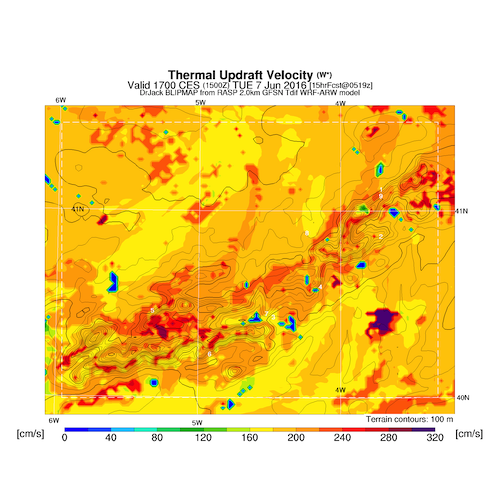
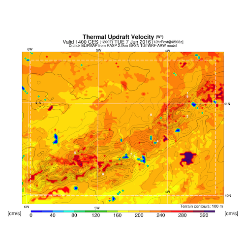
Looking potentially very good with SW convergence. Thermal tops c 2800 rising to 3000m .Convergence along south side of Sierra de Avila.
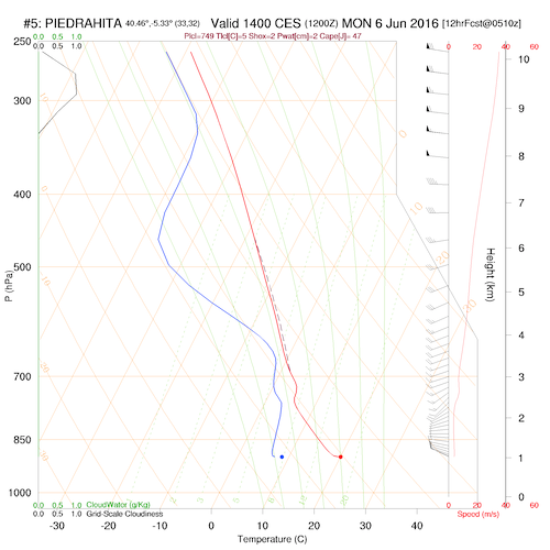
Difficult to predict how today will pan out. Far more unsettled with a frontal system moving through but mainly effecting the north of Spain. Far more unsettled in the E and N, but we may catch enough instability for some showers.
Winds a little stronger than the last few days , more westerly and likely to be converging over he hills.
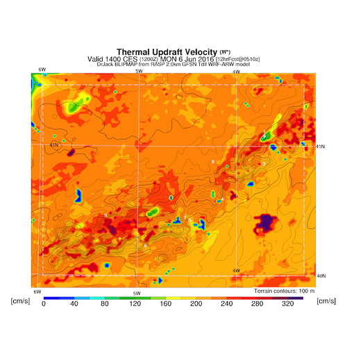
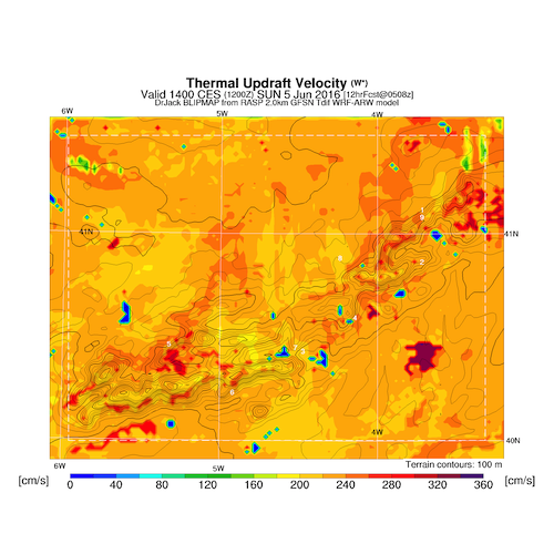
An interesting flight yesterday for Andy, following the convergence as predicted running more north from Muñogalindo towards the North. Being Sunday, and our arrival of new clients, Andy flew back again appox 20km of wind towards the Avila valley
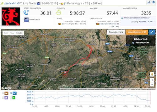
Andy´s flight
. Around 5 hours and 100km and back in time for Supper.
A north west with distance convergence formations along the main ridge and probably to the north side of the Avila valley. Should be comfortable on the ridge and a good opportunity for flights to Avila and possibly beyond today.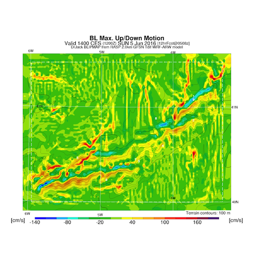
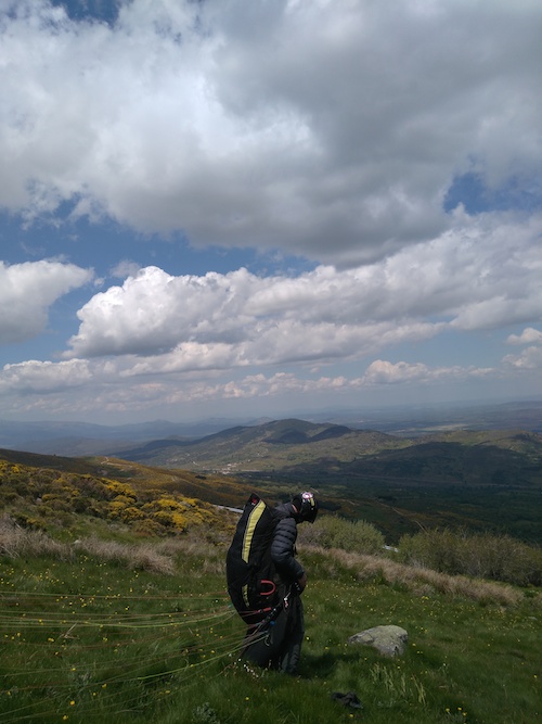
We opened a little earlier than expected as we had some interest from people fleeing the rain in other parts of Europe. Central and western Spain has been getting some rather good XC weather this week. Our little group has been venturing over the pass on a daily basis. Here is a Pic of Pete Douglas getting ready to launch yesterday. Also a caricature I painted of him a few years back.

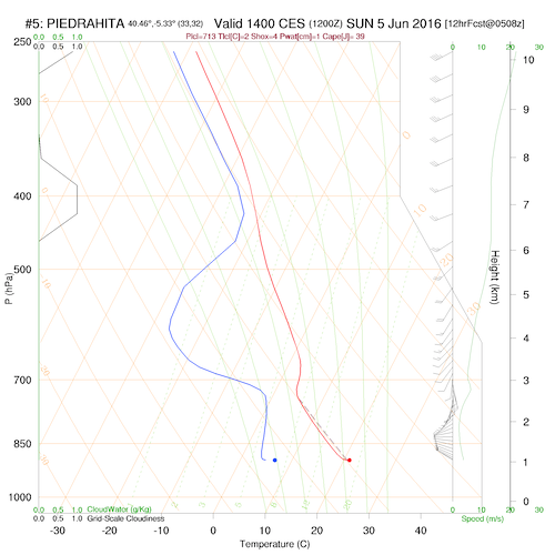
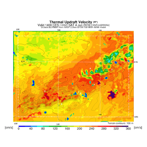
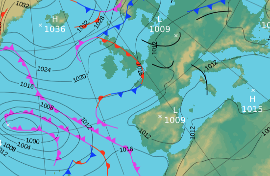
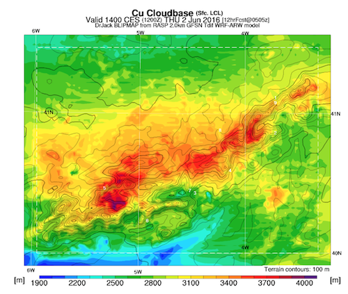
Today with have the Liga Centro visiting us. This morning at 8 am clear skies but low level mist forming around that time which I imagine will burn off before 11 am. Here are a few maps, which amongst others we will discuss at briefing.
Essential a decent XC day, with OK climbs, probably not getting going as early as yesterday. The NW aspect should make it pleasant on the hill, but also make flights beyond Avila a challenge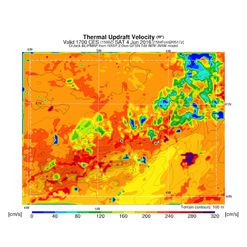
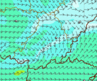
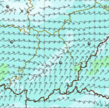
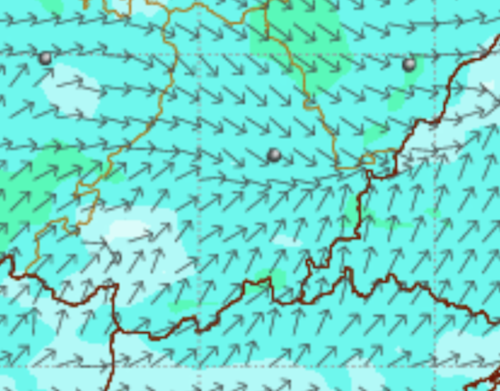
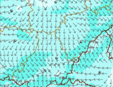
5 pm winds surface
mid day
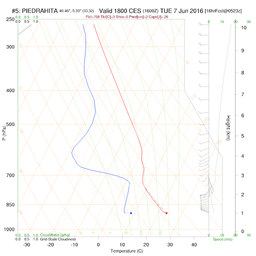
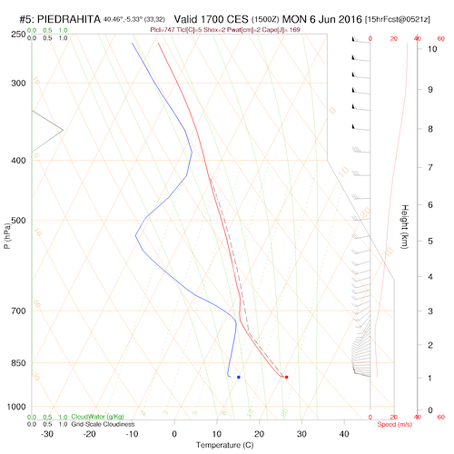
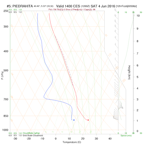
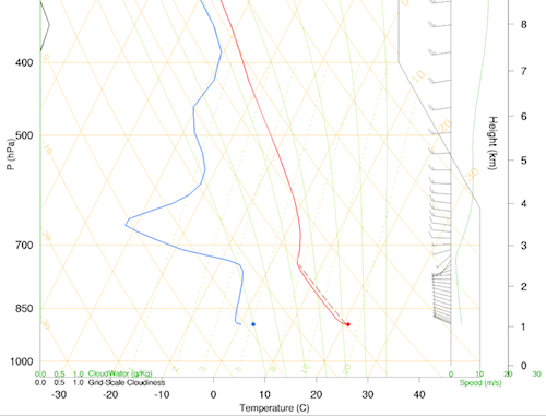
skew t 1600
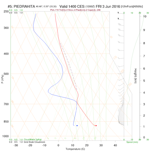
1400
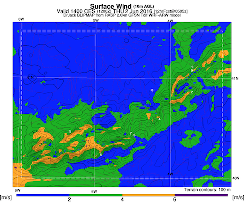
surface winds
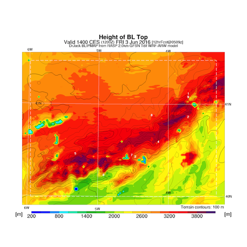
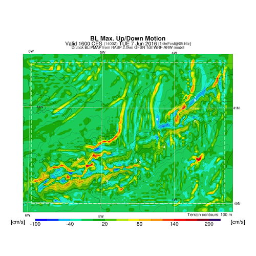
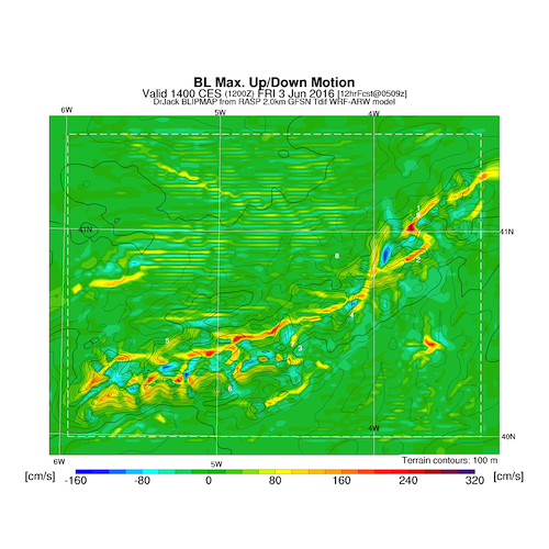
tops
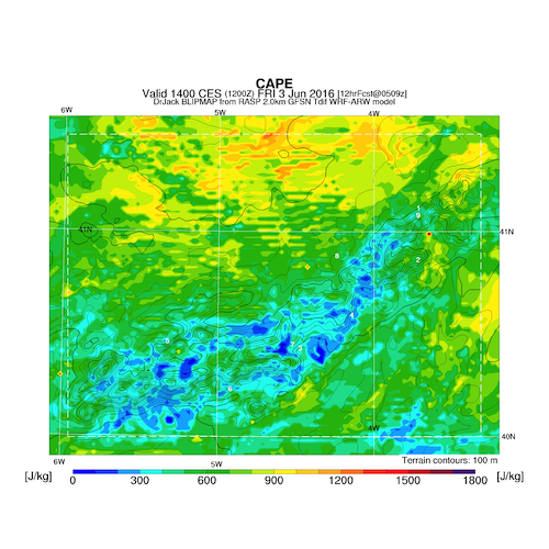
cape
convergence
Forecast for today Friday the 3rd of June.
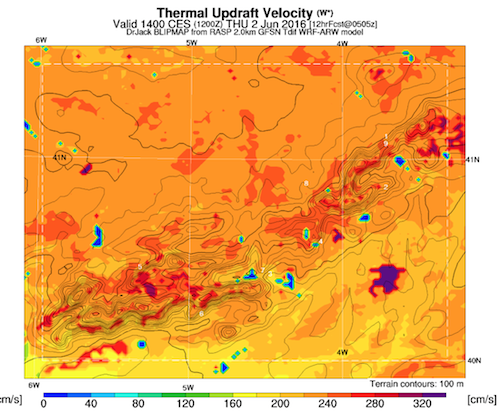
Essentially light winds from the west and decent climbs to over 3000m but with cloud building later in the afternoon at around 2800m. A certain level of instability and some congestus formation likely, but in our area initially unlikely to storm, though possibly some showers more to the East.
The forecast was about right. A nice days with light winds and buoyant conditions with a max by Tom of 3400m near Avila. Tom Flew back to from Avila to the Pass, Didier landing to he SE of Avila and Pete stumbling to the ground on the way around the bend in the road. A bit stormy tomorrow afternoon perhaps, but then getting good again. I am on driving duties as Jorge our driver does not start until Monday. These are warm up days, checking trackers etc.
We will discuss in a bit more detail in the briefing, but essentially a good soaring forecast with light NW winds and mainly blue thermals to below 3000m. Convergence on the Gredos mountains behind, but not for our take off area. A modest flight to Avila should be feasible.

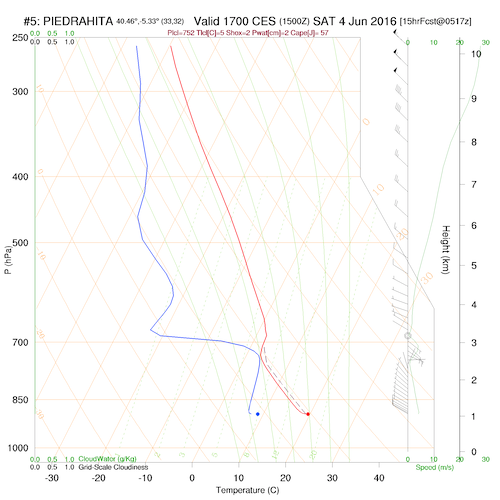
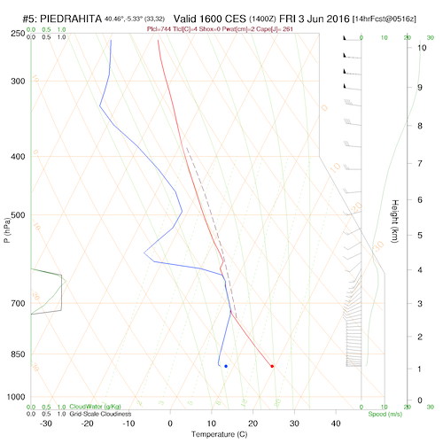
1600 skew piefrahita
2pm

 Here are two event designs I was asked to do for St Jean Montclar later this year.